

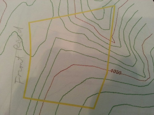
Please Help on the topo maps
houses14
10 years ago
Related Stories

GARDENING GUIDESGreat Design Plant: Silphium Perfoliatum Pleases Wildlife
Cup plant provides structure, cover, food and water to help attract and sustain wildlife in the eastern North American garden
Full Story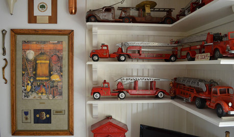
DECORATING GUIDESHouzz Call: What Home Collections Help You Feel Like a Kid Again?
Whether candy dispensers bring back sweet memories or toys take you back to childhood, we'd like to see your youthful collections
Full Story
GARDENING AND LANDSCAPINGBe a Citizen Scientist to Help Wildlife, Learn and Have Fun Too
Track butterflies, study birds, capture stars ... when you aid monitoring efforts, you’re lending Mother Nature a hand
Full Story
LIFEDecluttering — How to Get the Help You Need
Don't worry if you can't shed stuff and organize alone; help is at your disposal
Full Story
MOST POPULAR9 Real Ways You Can Help After a House Fire
Suggestions from someone who lost her home to fire — and experienced the staggering generosity of community
Full Story
WORKING WITH PROS3 Reasons You Might Want a Designer's Help
See how a designer can turn your decorating and remodeling visions into reality, and how to collaborate best for a positive experience
Full Story
MOVINGRelocating Help: 8 Tips for a Happier Long-Distance Move
Trash bags, houseplants and a good cry all have their role when it comes to this major life change
Full Story
HOUZZ TOURSMy Houzz: Saturated Colors Help a 1920s Fixer-Upper Flourish
Bright paint and cheerful patterns give this Spanish-style Los Angeles home a thriving new personality
Full Story
HOUZZ TOURSMy Houzz: Online Finds Help Outfit This Couple’s First Home
East Vancouver homeowners turn to Craigslist to update their 1960s bungalow
Full Story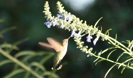
GARDENING GUIDESHow to Find the Right Native Plants for Your Yard
Find plant maps, sale sites and guides that make going native in the garden easier than ever
Full Story

carsonheim
renovator8
Related Professionals
Bonney Lake Architects & Building Designers · Fort Lewis Architects & Building Designers · Hillcrest Heights Architects & Building Designers · Hockessin Architects & Building Designers · Shady Hills Design-Build Firms · Fresno Home Builders · Sunrise Home Builders · Asheboro General Contractors · Bay City General Contractors · Dunedin General Contractors · Endicott General Contractors · Forest Grove General Contractors · Parkville General Contractors · Signal Hill General Contractors · Avenal General ContractorsOaktown
virgilcarter
houses14Original Author